.jpg)


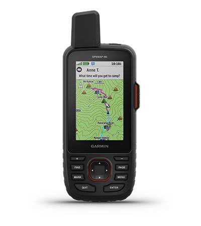
The rugged, portable GPSMAP 66i with satellite communication system combines reliable navigation options with global communication functions. It is equipped with Garmin TopoActive Europe cards and inReach technology®.
 Security policy
Click here to be redirected to our FAQ page
 Return policy
Click here to be redirected to our FAQ page
 Delivery policy
Click here to be redirected to our FAQ page

Guarantee safe & secure checkout
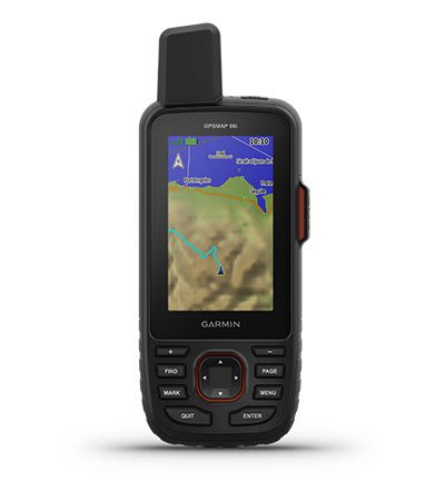
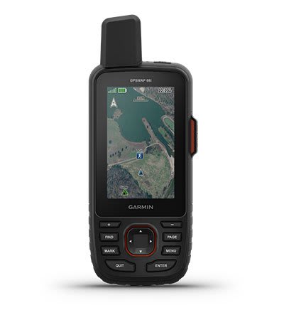
The portable, rugged GPSMAP 66i with satellite communications system combines reliable navigation options with global communications features. It is equipped with Garmin TopoActive Canada maps and inReach® technology.
Display readable in all light conditions. Use it in all conditions. The GPSMAP 66i is designed for you.
When mobiles can't connect, inReach can. Communicate with confidence.
Support for multiple GNSS allows you to benefit from superior navigation.
Get maps as beautiful and as detailed as photos, without a subscription.
Know the terrain before you go there with preloaded TopoActive maps of Canada.
Enjoy longer with battery life of up to 35 hours in Tracking mode and 200 hours in Expedition mode.
Access several satellite navigation systems (GPS and GALILEO) to orient yourself, even in the most difficult environments, where GPS alone is no longer enough.
Follow every route with ABC sensors including an altimeter for altitude data, a barometer to monitor the weather and a 3-axis electronic compass for orientation.
Download maps in high-resolution photo quality directly to your device without an annual subscription. Easily find trails, choose aid spots, find parking, create waypoints and much more.
Preloaded TopoActive Canada maps havedisplay peaks, parks, coastlines, rivers, lakes and landmarks.
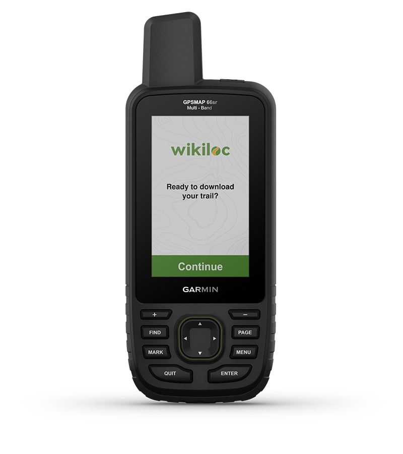
This preloaded app lets you easily download Wikiloc hiking, biking, and other trails shared by outdoor enthusiasts outdoorsy like you. For 60 days, try Wikiloc Premium and other exclusive features for free. Learn more.
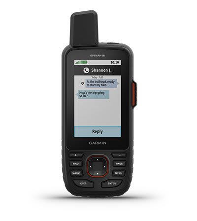
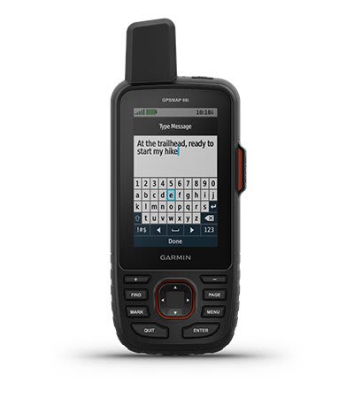
Exchange text messages with family or friends, post messages on social media, or communicate with other inReach devices on field. Satellite subscription required.
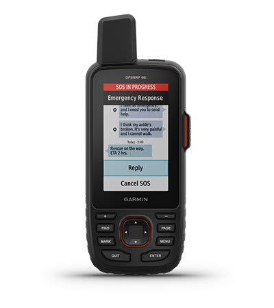
In case of emergency, send an interactive SOS to Garmin Response℠, a 24-hour emergency response coordination center /24/7 (satellite subscription required).
Track your location and share it with those at home or in the field. They will be able to see your progress or locate your GPS location and much more. Satellite subscription required.
Instead of going through the mobile network, your messages, SOS alerts and tracking data are now transferred via the global network of Iridium satellites. Satellite subscription required.
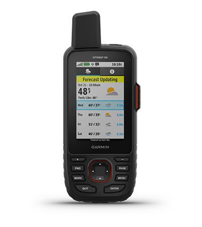
Use inReach connectivity to get detailed weather updates on your GPSMAP 66i or compatible device paired with Garmin Explore™ Use inReach connectivity to get detailed weather updates on GPSMAP 66i or compatible device coupled with the Garmin Explore™ app. Request the weather forecast for your current location, waypoints or destinations on your route.

When paired with your compatible smartphone you can get real-time forecast information and real-time weather radar data. You are therefore always informed of the conditions in your environment.
The GPSMAP 66 series lets you keep your equipment to a minimum with a built-in LED flashlight that can be used as a beacon to signal your location in case of trouble.
Plan, view and sync waypoints, routes and tracks using the Garmin Explore mobile app and website. You can even view past activities while you're still in the field.
Activate Expedition Mode and get up to 200 hours of battery life when using inReach technology. The default tracking mode gives you up to 35 hours of battery life and your device records and sends your location every 10 minutes.

Easy to Read Display
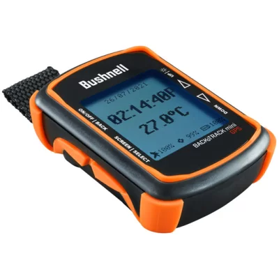
Built-in Digital Compass With Temperature, Time, Barometric Pressure, and Elevation.
Provides the Best day or times of day to Hunt or Fish based on moon phases
Glove Friendly Buttons
Includes tether and carabiner to connect to your backpack, belt or jacket.
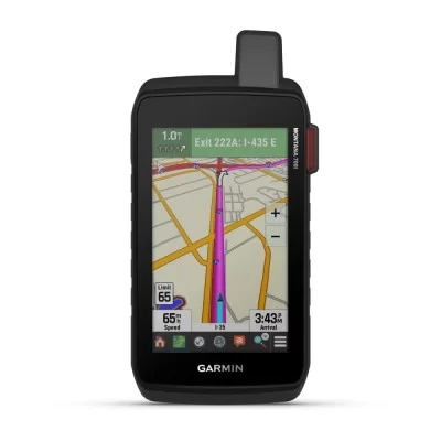
To allow adventurers to keep in touch and stay on the right path, they will, the Montana 700i handheld device combines the flexibility of on-road and off-road navigation with messaging functions worldwide and interactive SOS via inReach satellite technology.
ZOLEO Connect ensures seamless communication no matter where you are. With advanced satellite technology, it allows you to send texts, emails, and SOS alerts even in the most remote areas. Stay connected, stay safe with ZOLEO Connect.
This compact satellite communication beacon allows you to stay close to your family when you're not connected, for total peace of mind with every adventure, without weighing yourself down.
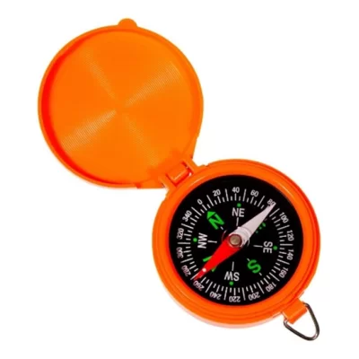
North 49 LED Light Compass, Includes: Replaceable Batteries